

Scotland September 2003 - Part II of II
Easter Aquhorthies - Stone Circle - All of the above and below pictures are in order of our trip, as we continued around the coast. After returning home, neither Kim or I could remember where the Easter Aquhorthies were located. Ok, I know they are somewhere in Northern Scotland, but we aren't exactly sure where... If you know, let us know and I'll move them to the correct spot. Either that, or I can leave the picts where they are, and keep the story.
Rather than me try and explain what the Stone Circle is all about, I have been nice and have taken pictures of the offical posters.
As we looked around, we decided a quick look at the countryside would be in order. All the bails of hay are ready for the long winter. Do you wonder why some bails are square and some are round?


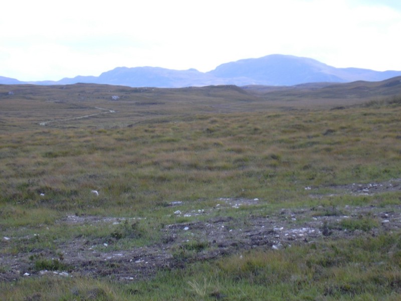
The surrounding area has quite a few mountains.

Even though it was late in the fall, there were these little flowers that dotted the road to the stone circle.

In the top right of the picture, this is our first glimpse of the circle and the stones.

In order to keep the weather gods happy, we decided that a sacrifice was in order.

First, you have to find the right stone for the ritual.

Since neither Kim or I wanted the glory, we took a vote, and decided that Seth would be a good offereing.


It just looks like Seth is saying "Don't just leave me here..."


Doesn't this look like a big sofa? It comes with arm rests and everything!

Dornoch Castle - Dornoch Castle is a little north of Inverness along the East coast.
This is looking from their mile long tree lined driveway (or it seemed like a mile), looking onto the castle. Just behind the castle is the ocean. Pretty nice location for a summer home. There have been a lot of famous people that have visited the castle, and one painting of someone that looked like George Washington. It wasn't him, but he sure could have been his body double. I guess it could be that everyone looked like George a couple of hundred years ago. Same hair (a wig), same poofy kit (clothes), and a cheeky grin.

This is from the back of the castle, looking up at the rooms above. We couldn't go much further as it was roped off.

A wee balcony for the rich to look upon their kingdom below.

Kim and I had a long discussion about the gargoyles. I originally thought they were Scottie dugs, but, Kim won out as she said that they were wild cats. Oh meow!

Here is Kim admiring the gardens below. We were going to run down to the beach, but we were tired, and Seth had been on his wee feet all day. So, we just decided to use the zoom lens and take pictures of the gardens below.

Down below is the round gardens, water fountain, and just behind the trees was a falconry show, and beyond the clearing is the beach and ocean. The falconry shows are quite popular in the UK. We have seen quite a few shows before, and have also handled many birds of prey (check the Braco webpage).

And just to the right of the gardens is another section, including a large water feature.

John O' Groats - The two furthest towns in the UK are from Lands End in England to John O' Groats in Scotland. The total distance is around 840 miles. To put this into Canadian terms, when we drove from Kamloops to Anchorage, that trip was about 2000 miles (one way). Our trip from Vancouver to Toronto was around 2800 miles (one way). These figures are according to multimap.com, so that would be the most direct path. We, of course, don't take the most direct route, so those numbers would be quite on the low side.
This is almost at the end of the road and mainland. Beyond the water is the start of the Orkney islands.

It's official. This is definately the end of the road, and the North & West Highlands Tourist Route. I like the sign on the post "Reduce Speed Now". How about another sign saying something like "End Of Road" or "Get In Your Boat". Or, even just "Stop". At the end of the road is a little tourist shop, a passenger ferry dock, a couple of stands selling ices, and a little canteen.

Just down the coast from John O'Groats is the Ness of Duncansby. We thought it was another town or something, but I think it was just the beach.

Along the way to the Ness Of Duncansby, we found another heeland coo.

Just beyond the beach is the Orkney Islands. Pretty nice beach. Fun for finding lots of wiggly sea creatures. Seth caught a lobster, a seal, and a dolphin, but he released them all.

Water, water everywhere, and not a drop to drink. So, we went to the pub.

As we continued down the coast, we stumbled upon a lighthouse.

Isn't this a beautiful cove? You have the cliffs, lighthouse, crashing waves, and a sandy beach. What more could you ask for?
To view the entire picture, hold the right arrow key down.

Since this is the top of the UK, this is a major shipping lane.

To get to the Orkney Islands (or to get to John O'Groats from the islands), you can either swim a long ways, or take one of the ferries. And, hey, look at what we have in this shot? Enter a ferry. There's also a seal trying to steal the limelight.

This is looking back at John O'Groats from the Ness Of Duncansby.

Kim and Seth ponder life and listen to the splooshing of the waves.

Oh whoo's thee leeettlee babbie?? Whooo izz hee??? Awee duzza wazza.

Nessie has followed us from Loch Ness.

Here is Nessie surfing in the waves.

Nessie is watching us...

Nessie found a friend. Humm... Maybe we'll have baby Nessies soon.

Good bye from Nessie and John O'Groats.

Orkney Islands - The Orkney islands are located north of John O'Groates. Some of the islands are a stones throw away from John O'Groates (ok, if you have a really good arm, and you skip the rock a couple of times, and you are helped by a friendly seal). We took a short to St. Margarets, which is on one of the main islands. This took about an hour on the ferry.
Here are several islands along the way. When you take the ferry, it was about �10 per person. The main problem that we had was they don't take Visa, Mastercard or cheques for the voyage. No problem. We had just enough money for the crossing, and enough for a couple of scones with jam. Num.
On the way to the Orkney's, Kim was off paying for our crossing, Seth was sleeping (long night of partying), and I was gazing out the window. While I was admiring the scenery, guess what I saw? Porpoises. Then when I pointed them out to some American tourists, they said "What?". I repeated it, and they said "Wha?" So, I said, "Dolphins" and they understood that. Then when Kim came back, she didn't believe me.

See on the left side of the island, are those weird buildings. I believe they were something to do with the War defences. Liz, do you want to verify that??

The other thing you sometimes see, is abandoned farm houses scattered all over the hills. The reason the houses aren't occupied isn't because of a famine and they've all moved away, but because the farmers were kicked out, so that the animals could graze on the land.

After about an hour on the ferry, we were in dire need of cash (since they didn't take plastic). We wondered over to the city to find a bank or machine or some sort of money printer. Well, it seems that the village of St. Margarets didn't have any sort of on-line banking systems. We were totally stuck. One villager's suggestion was to get either in the once-every-3-hours bus, and travel for an hour to the bigger town on the island, or get a 30 minute taxi ride. Now, you have just enough money to buy a bag of crisps, it's lunch time, and you're getting hungry, and you have no way of leaving or doing anything in the town. What would you do. Take a moment to ponder this puzzle. While wondering around the town, we asked if there was either a bank (no), cash point (no) or any way to get some cash. The nice teller at the post office had to pay a M&S bill for �38 - so, we payed her bill with our plastic, and she gave us the cash. It was a very creative solution to a very remote problem. Anyhoo, we got off the island, and had just enough cash for some ices on the voyage home. Unfortunately, there were no dolphins on the return trip.

North Coast - The following pictures are between John O' Groats and Scourie, during our drive back to civilization.
I always thought of the UK as having more rolling hills, creeks and stone bridges, something like what is in "All Creatures, Great And Small". And, then, along comes a mountain range or two.

The beaches were absolutely brilliant. From white to golden sand, the ocean lapping on the shore. It was such a shame that it was late in the summer, or else this would have been a perfect spot for a dip. Being so far north, there were very few people. We only saw a handful of tourists, and maybe two handfuls of locals. There is also nobody on the beach, not even a beachcomber or a dog. Actually, on a second look (after rereading this section) I don't even see a bird. That is weird... Oh, down on the bottom are sheep. Ok, that is ok.
To view the entire picture, hold the right arrow key down.

Some of you might remember our pictures from the Yukon and Alaska. This really reminds me of the terrain you would get up there.
Just to proove that the above sandy beach picture wasn't a fluke or one accidentially added from our Greece pictures, here is another great example of the northern beaches. The color of the water is almost Med like.
To view the entire picture, hold the right arrow key down.

This poor little hermit in the old castle isn't aware of any of the modcons, such as TV's, diswashers, central heating, microwaves, insulation, roofs, etc. He does have one oldcon, and that would be his sheep, which trebbles as a coat, lawn mower and a companion.

This is more of what you would expect of Scotland - rain, fog, clouds, and a rainbow. We were actually very fortunate, as this year has just been great, weather wise.
To view the entire picture, hold the right arrow key down.

Scourie Traffic Jam - Even though we were in the middle of nowhere, traffic jams can still happen. This is in the wee village of Scourie.

This just prooves that heelendcoos aren't just in the calendars and postcards.

See the one on the left? He decided that she'd rather go off and do some exploring. The sign on the drive said there was vacancies, so why not check it out.

Beinn Air Da Lock - After getting a relatively early start to the day (thanks to Seth deciding that 5:30am is a respectable time to get up), we decided to leave our comfy B&B in Scourie for the great unknown on our trip south. The
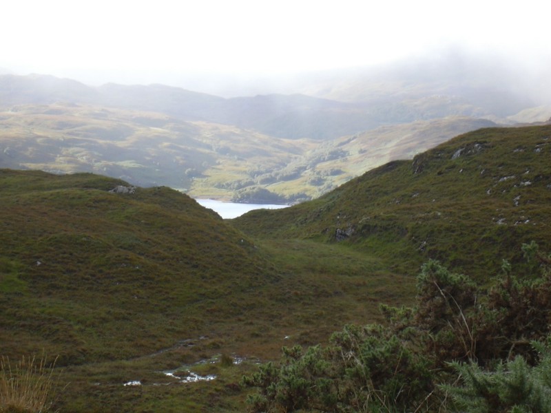
After about an hour, we decided to stop at a little rest stop and found ourselves in this little valley around Beinn Air Da Lock. Beinn Air Da Lock means "mountain of the high point between two locks". The lock is Lock Gleann Cuil, which means "loch of the glen at the back". And the other mountain is Stac Gleann Cuil, which is ofcourse, "the stack of Gleann Cuil". The other lock was Loch a' Ghlinne Dhuibh, or "loch of the black glen". Even with these interesting names, it is still easier to pronounce then any of the Welsh towns or lakes we visited (check out our Wales page).

Is that a weird sheep on the horizon? Let's zoom on the picture and see what it is...

Well, I'll be. Deer! Biggins too!

This picture is at 200%, so I've lost a little resolution, but it's still pretty good.

Here is a wide angle picture of the valley below, and the mountains beyond.
To view the entire picture, hold the right arrow key down.

Hey. Where did they go. Oh well, now we can view the wilderness without distractions.

And a little closer view of the hills and the lochs.
Hey! Guess who came back! They came back for a little wander around, had a chew on some grass, and, went back to their deer dens.

Eilean Donan Castle - If you've ever had a calendar of Scotland, this castle is always included. It is the Eilean Donan Castle, just north of Fort William. This castle was also used in the movie Highlander. You have to admit, the fog really does add to the mysticisim.
To view the entire picture, hold the right arrow key down.

Highway Finds - The following pictures are in the middle of nowhere (actually I can't remember) along the open road.
More proof of heelendcoos do infact exist.

180 degrees from the heelendcoos, were quite a few oil wells. I am guessing that they plant them in the water, as that makes the oil lighter (because oil is lighter than water) so it floats to the surface easier. There were about half a dozen oil wells along the firth, so it must be quite a good well.
To view the entire picture, hold the right arrow key down.

This mansion wouldn't be so impressive if it was in the middle of town (actually it still would be), but the weird thing is that it was in the middle of absolutely nowhere, on a lonely single track road (which was the main highway) miles from the closest house.

It is good that the roads are so straight, as this way you can see people coming (unlike the windy single track roads in England). What a beautiful time of year.

Right... which way shall we go? Straight, or, umm, straight. It is a good thing too, since this is another single lane highway.

Fort William - Our last night found us in Fort William. It is close enough to make it a day trip, but far enough to enjoy the remoteness. Fort William is also home to Ben Nevis, which is the tallest mountain in the UK. If you check my pics from last year, there might be some pics of Ben Nevis.
Below is a panoramic picture of the firth.
To view the entire picture, hold the right arrow key down.

The UK has been voted as one of the worst countries in Europe for health, lifestyle and eating habbits. Now, with a place that is advertising pukka-pies, is there any doubt? And, no, I have never eaten a deepfried Mars bar (honest - it's now available)!
